
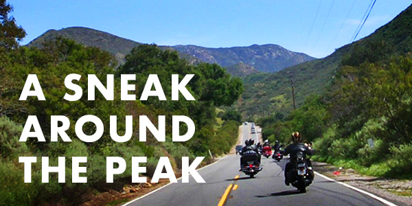
This installment of the Fuel Fed Fun Guidebook we take you around SADDLEBACK, the mile high backdrop we see nearly everyday here at Blacktop Magazine.
Santiago and Modjeska, the two highest peaks of the Santa Ana Mountans along a ridge bordering Orange and Riverside Counties in Southern California make the illusion of a saddle as viewed to the east from most of Orange County, California.
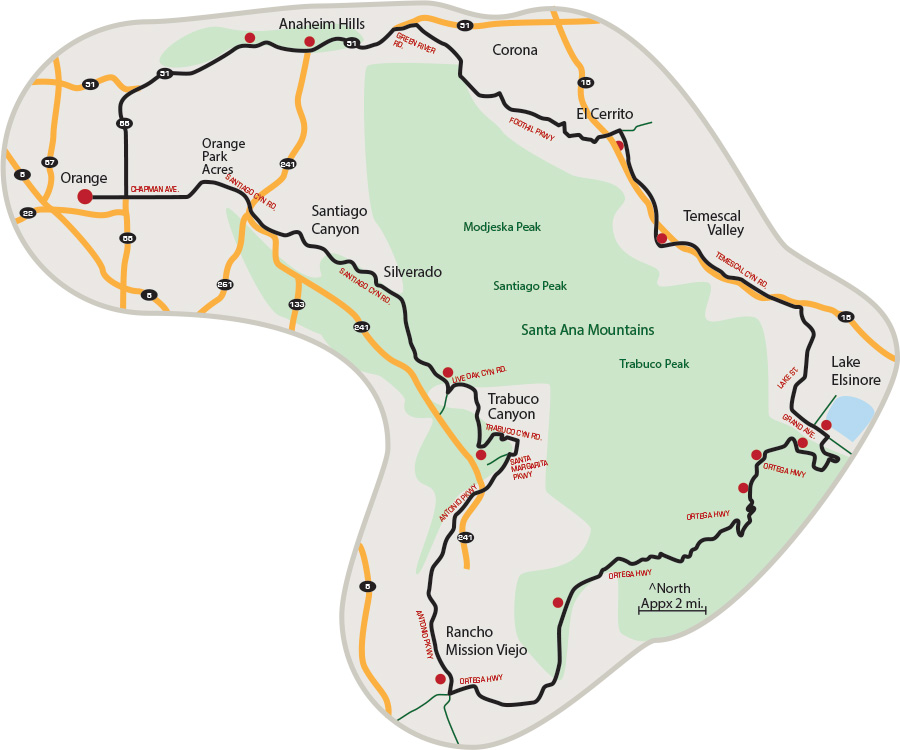
We start in Old Towne Orange at the Circle or Plaza, depending on who you are talking to. Plenty of restaurants and vintage shops around the plaza. The area is the largest historical district in California. From there we head east on Chapman Ave which turns into Santiago Canyon Road when you pass Jamboree Road. The gentle winding road rolls through historic foothills of Orange County. You will pass Irvine Lake and several adjoining canyons that lead up through fairly percarious dirt roads to Santiago Peak. Continue on Santiago Canyon and turn left at Cooks Corner (a locally world famous biker/cowboy bar). Live Oak Canyon Road will take you through oak tree covered passage and past O’Neill Park and up Trabuco Canyon Road to Robinson Ranch. Turn right on Santa Margarita Parkway and left on Antonio Parkway where you travel along the foothills of Coto de Caza through Tijeras Creek and down to Rancho Mission Viejo and Ortega Hwy (CA 74).
A left turn on Ortega Highway and you go up through a windy mountain road to the top of Trabuco Peak where you will find a couple of stops at Hells Kitchen (another biker bar and grill) and Lake Elsinore Lookout Point on the left. A steep downhill brings you to the city of Lake Elsinore.
We stick to the left on Grand Ave. which turns to Lake Street at Lakeshore Drive. In Alberhill, we turn left on Temescal Canyon Road which is fairly straight along Interstate 15 beside the foothills of Corona Lake and Lake Mathews and into Temescal Valley. A fun stop is at Tom’s Farms. A family friendly park with restaurants, a farmers market, and some rides for the kids.
A left turn at El Cerrito Rd takes you under Interstate 15 and onto Foothill Parkway where we ride along the south and west sides of the city of Corona. Foothill turns into Green River Road as we head north towards CA 91. We merge onto the 91 and head west along the Santa Ana River where we pass Canyon RV Park in Featherly Regional Park and Anaheim Hills before heading south on CA 55 to Chapman Ave and east on Chapman where we end the approximately 110 mile loop back at the Orange Plaza.
SUGGESTED STOPS
Old Towne Orange
Intersection of Chapman Ave and Glassell Streets, Orange, CA
View of the Pacific Ocean
Just as Chapman Ave. curves to the left, stop at Orange Hill and look west over the city of Orange and down to the Pacific.
Irvine Lake
Santiago Canyon Road
Cooks Corner
Santiago Canyon Road at Live Oak Canyon Road.
O’Neill Park
Live Oak Canyon Road at Trabuco Canyon Road.
Sendero Farms
Antonio Parkway at Ortega Highway
Ronald W. Caspers Park
Ortega Highway
Hells Kitchen
Ortega Highway
Lookout Point
Ortega Highway at Lookout Roadhouse
O’Hara’s Rock and Roll Tavern
Grand Ave. at Ortega Hwy in Lake Elsinore
Tom’s Farm
Temescal Canyon Road at
Interstate 15
Wood Ranch BBQ
Dos Lagos Park
Featherly Park
CA 91 at Gypsum Canyon Road


